Map of Chicago
Updated · BootsnAll
Chicago is one of the easiest big cities in the world to find your way around, once you know two things. The lake is always east. And every address tells you how far you are from one downtown corner. Learn the grid on your first afternoon and you'll rarely need your phone to know roughly where you are.
Most of what visitors come to see sits in a small area: the Loop, River North, and Streeterville and the Gold Coast along the Magnificent Mile, plus the Museum Campus and Grant Park on the lakefront. All of it is walkable, and the L and buses cover the rest.
How the grid works
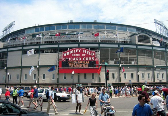
Every address in the city is counted outward from the corner of State Street and Madison Street in the Loop. State is the zero line for east and west, Madison is the zero line for north and south. So 400 N. Michigan Ave. is four blocks north of Madison, and 1060 W. Addison St. (Wrigley Field) is just over ten blocks west of State.
The key number is 800. Chicago addresses run at roughly 800 to a mile, so eight standard blocks make a mile, and a big street shows up every mile, with a secondary one every half mile. Once you know that, you can work out distances in your head. Going from 800 N to 2400 N is two miles, or about a 40-minute walk.
These are the anchors worth memorizing.
- North: Chicago Avenue (800 N), Division (1200 N), North Avenue (1600 N), Armitage (2000 N), Fullerton (2400 N), Diversey (2800 N), Belmont (3200 N), Addison (3600 N), Howard (7600 N, pretty much the northern edge of the city).
- South: Roosevelt Road (1200 S) and Cermak Road (2200 S). South of Madison most east-west streets are numbered, and the numbers match the addresses, so 95th Street is 9500 S. The same logic takes you to the Museum of Science and Industry (officially the Griffin Museum of Science and Industry now) at 5700 S. DuSable Lake Shore Drive, near 57th Street.
- West: Halsted (800 W), Ashland (1600 W), Western (2400 W), Kedzie (3200 W), Pulaski (4000 W), Cicero (4800 W).
- East: there isn't much, because the lake gets in the way. Michigan Avenue is 100 E.
Two more rules. Even numbers are on the north and west sides of a street, odd on the south and east. And diagonal streets like Milwaukee, Lincoln, Clark north of downtown and Ogden are numbered as if they ran straight, which is why Milwaukee Avenue addresses in Bucktown can feel off until you check them against the cross street.
You'll also see a newer name on maps. In 2021 the City Council renamed the outer drive, from Hollywood Avenue to 67th Street, DuSable Lake Shore Drive, after Jean Baptiste Point du Sable, the city's first non-Indigenous settler. Most people still just say "Lake Shore Drive" or "LSD."
The L map
The CTA's eight L lines are named by color: Red, Blue, Brown, Green, Orange, Purple, Pink and Yellow. Download the official system map (PDF) or the simpler L-only map (PDF) from transitchicago.com. There's also a downtown transit and sightseeing guide that's more useful than most tourist maps.
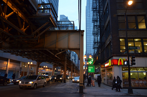
The Loop itself is named for the elevated tracks that circle a rectangle formed by Lake Street, Wabash Avenue, Van Buren Street and Wells Street. The Brown, Green, Orange, Pink and Purple lines run on it, according to the Loop's Wikipedia entry. The Red and Blue lines run in subways under State and Dearborn, and they're the only two that run all night, per the L's own entry. The Blue Line goes to O'Hare, the Orange Line to Midway, and the Red Line to Wrigley Field at Addison. More on fares and passes in our transportation guide.
Getting oriented by neighborhood
Downtown is small. The Magnificent Mile runs about a mile from the Chicago River to Oak Street, so it's a 20-minute walk end to end if you don't stop, and you will stop. The Loop's elevated rectangle is smaller than that on each side.
North of downtown, the lakefront neighborhoods stack up in order. Old Town is around North Avenue, Lincoln Park and the zoo sit roughly between North and Diversey, and Lakeview runs north from Diversey to Irving Park Road, with Wrigleyville wrapped around the ballpark at Addison. The Brown and Red lines get you to all of them.
Northwest, along the Blue Line and Milwaukee Avenue, are Wicker Park and Bucktown, with restaurants and bars in the blocks around the Damen stop. West of the Loop, past the river, the West Loop's restaurant row sits along Randolph and Fulton Market, and Little Italy is along Taylor Street, south of the Eisenhower Expressway.
South, the Museum Campus (the Field Museum, Shedd Aquarium and Adler Planetarium) sits on the lakefront just past Roosevelt Road. Hyde Park and the Museum of Science and Industry are about seven miles south of the Loop, which is where the grid math starts to matter. See how to get to the Museum of Science and Industry.
To the west, just past the city line at Austin Boulevard, is Oak Park, on the Green and Blue lines. Our list of neighborhoods to visit using public transportation goes further, and where to stay in Chicago matches neighborhoods to trips.